Very informative site, plenty to return to for further study.
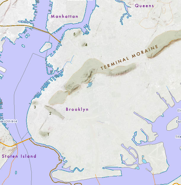
I’ve been trying to find a map (online) that indicates the substantial change in topography (elevation) that occurs along the terminal moraine, shown above.
I am specifically looking for some overlay of the topo of the moraine above with the actual city street grid.
For example, in Jamaica, Queens, St John’s University, Jamaica High School, are built on what appear to be the highest points in the borough, I’m assuming on the crest of this moraine.
Just south of Jamaica HS, starting at ‘Hyland Ave’, there is a substantial drop in elevation, within 1 block, to Hillside Ave (Hyland and Hillside are not accidental names here). Over the years, there have been instances of catastrophic flooding of the IND stations: 169th St and Parsons Blvd @ Hillside Ave, during heavy rains, that closed down the entire Queens line, largely because Hillside Ave is a plateau for all rain run-off just to the north.
Elevation continues to decline south of Hillside, essentially all the way to Jamaica Bay.
In trying to explain this feature in context of the street grid, I have been looking for a ‘combo’ map that would show both the geology and the street grid.
Do you know of any online? Thanks BJK
Densye's Ferry originally at the site of the present-day Verrazano Bridge. From a print in "Historical and Antiquarian Scenes in Brooklyn and Vicinity" by T.W. Field (1868).
Very informative site, plenty to return to for further study.
I’ve been trying to find a map (online) that indicates the substantial change in topography (elevation) that occurs along the terminal moraine, shown above.
I am specifically looking for some overlay of the topo of the moraine above with the actual city street grid.
For example, in Jamaica, Queens, St John’s University, Jamaica High School, are built on what appear to be the highest points in the borough, I’m assuming on the crest of this moraine.
Just south of Jamaica HS, starting at ‘Hyland Ave’, there is a substantial drop in elevation, within 1 block, to Hillside Ave (Hyland and Hillside are not accidental names here). Over the years, there have been instances of catastrophic flooding of the IND stations: 169th St and Parsons Blvd @ Hillside Ave, during heavy rains, that closed down the entire Queens line, largely because Hillside Ave is a plateau for all rain run-off just to the north.
Elevation continues to decline south of Hillside, essentially all the way to Jamaica Bay.
In trying to explain this feature in context of the street grid, I have been looking for a ‘combo’ map that would show both the geology and the street grid.
Do you know of any online? Thanks BJK